Monday, April 8, 2013

Ten Days in Istanbul

Our last day in Istanbul. We're tired, and the weather is lovely,  so we decide to spend the day riding ferries. I had thought we could find ferries to take us from ferry landing to ferry landing up the Bosphorus to stop and see sights along the coast, but alas, we could not find these ferries, so eventually we opted for the short one-hour cruise.
The fortress at Rumeli Hisari was built on the European side of the Bosphorus by Mehmet II, the Conqueror,  to match  an older fortress on the opposite Asian side, allowing him to control all traffic on the water as he laid siege to the city of Constantinople.  800 years of failed attempts required some new clever strategies to succeed. He bypassed the chain used to close the Golden Horn, by having his army carry 80 galleys overland from the Bosphorus on a mile long plank road he built.  The ships could then be launched directly into the Golden Horn. The siege lasted less than two months.
Looking up the Bosphorus to the Black Sea whose borders include Turkey, Bulgaria, Georgia, Romania, Ukraine,
 and Russia. The Bosphorus is only 20 miles long, but its strategic importance is incalculable.
It is Russia's only outlet to the Mediterranean Sea.
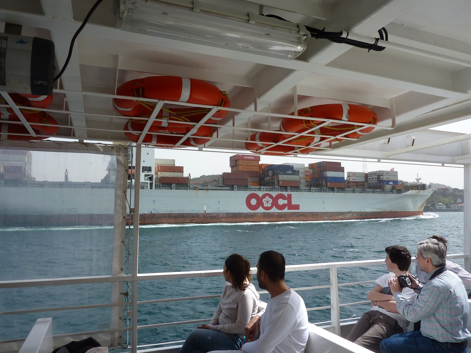
It is one of the world's busiest shipping lanes with tankers and container ships
— this one said Chicago on the front — carrying grain from Europe's breadbasket and oil from Russia .
After supper at the favorite fish restaurant we had eaten at earlier in the week,
we took a last look at the exterior of the magisterial Haghia Sophia.

Saturday, April 6, 2013

Nine days and nearly done

Our holiday is winding down and the weather is perfect so wandering to see the things left undone was the plan for the day. Bob saw a notice about this exhibit in Time Out Istanbul monthly magazine when we arrived, so we headed to the other side of the Golden Horn.
The exhibition was not very exciting because there were no original maps on display, just photographs of  very old maps that will be available as a coffee table book on historic maps. The university art center building hosting the exhibit was much more interesting. The Cannon House was the Ottoman Empire's military foundry established by the Conqueror himself, although this building dates from the early 19th century.
The exhibit's focus was cartography prior to 1513 when the Piri Reis map was  drawn using sources that have long been lost, including Columbus's original maps of the Caribbean. Only the western third of the map is extant, but that includes the east coast of Brazil making the map one of the earliest maps to include depictions of the New World.  Piri Reis was an Ottoman admiral and cartographer, and the map is in the Topkapi Palace Library collection. ( I forgot to take a photo of the photo map, so this image is borrowed from Google images.)
Then we moved on to a truly unique museum, Turkish Nobel Literature Prize winner Orhan Pamuk's Museum of Innocence. As a young writer, he conceived the idea of writing a novel told through the material objects that define a person's life in the place where the life is led. He began collecting everyday objects with a vague idea in mind for the novel, which as he writes in the book about the museum (above right) became an obsession during the late 1990s. When he began seriously planning the project he realized he had to have a place to set the novel before he could begin writing if the idea was to work.
He bought and renovated this house, which is now the Museum of Innocence, as he wrote the novel with the same name.  Open to the public for rather an enormous fee (25 Turkish Lira, the same price as a ticket to Haghia Sophia or to Topkapi Palace) unless you are carrying the book with you. Then you are admitted free. Bob's copy (above left) bought for 25 Turkish Lira – you can do the math, but at least we now have the book to read, not just a ticket stub — gave him free admission and a special stamp on page 520. (I also borrowed this photo from Google images.)
The museum has a special vitrine display for each of the book's 83 chapters.  Above are Chapters 2 through 5. Not having yet read the book, traveling through the 83 chapters was fascinating. Through the artifacts, I have an idea of the events that transpired, but no grasp of the story line. No photos were permitted, so this too is from Google images.

We ended the day by walking across the Galata Bridge over the Golden Horn.
The lower level is for eating fish.
The upper level is for catching fish a for walking.
The Old City ahead . . .
The Bosphorus to the left . . .
The Ataturk Bridge to the right . . .

Thursday, April 4, 2013

Eight Days On


I can understand why people are so intrigued by Istanbul. The history is so deep, with so many layers, and somehow they all still have a presence in the city today. Moving through the city is moving through a time machine of cultural history. Today was not an entirely successful day in that we were looking forward to visiting the Naval Museum, only to discover on arriving that the museum will be closed until summer to complete the building works of a huge new wing. At the ferry terminal next to the museum was this huge monument to Barbarossa, the pirate, the slave trader, the diplomat, and the admiral of the Ottoman fleet during the 16th century. 
Nearby the closed Naval Museum was the closed Dolmabaçe Palace. The palace is regularly closed on Thursday, so we were not surprised or disappointed, but in the time travel history, this is the palace built by the modernizing sultans of the 19th century to pull the mouldering Ottoman Empire into the world of European glamour. They gave up the medieval Topkapi in favour of a place where the royalty of Europe could drop by for a visit. Of course they didn't give up the bizarre world of the Harem when building a modern palace. Jason Goodwin's 4-volume (so far) mystery series about Yashim the Eunuch set in  the 1830s is a wonderful resource for painlessly learning about the lives of the Ottoman rulers.
The next step in modernising was to create a shopping street promenade like  other European capitals. The  Grande Rue de Péra was lined with shops and cafés and embassies and churches (but not mosques). Today with a Turkish name Istiklal Caddessi, it is indistinguishable from Oxford Street in London except that it is technically pedestrianized . . .
. . . and has a charming San Francisco style cable car running on the old tram tracks.  The street is on  the eastern side of the Golden Horn, and the street is so steep that there is a funicular — a very modern funicular – that runs to the top of the street from the Bosphorus side and another that runs from the Golden Horn to the bottom of the street.
Many of the grand old buildings still line the street. The embassies have become consulates now the Turkish capital is in Ankara. Old hotels and shopping arcades offer a taste of how Grande the Rue once was,
Returning to our Time Travel, Istiklal ends abruptly at the lower  funicular, and the 19th century reverts to a medieval warren of nearly impassable alleys pitched at a roughly 45 degree slope down to the Golden Horn. Once upon a time, this area belonged to the Italian city state of Genoa. When the Fourth Crusade army decided to sack Constantinople in 1204 rather than go on to Jerusalem, after they packed up the city's treasures and sent them to Venice and other Italian city-states, Constantinople was parceled out to the Italians. In the 1260s, when the Greek Palaeologus family recaptured Constantinople, they cut a deal with the Italian city-states to keep areas of the city for trading concessions. The Genoese kept Pera and built fortified walls around their concession including the Galata Tower rebuilt in 1348 from a 6th century lighthouse.
Other buildings are still in use that were part of the medieval Genoese community.
 The Italian concessions were ended when the Conqueror took Constantinople, although Pera continued to be the quarter where Europeans lived during Ottoman rule. Another group who populated this area late in the 15th century were the Sephardic Jews expelled from Spain in 1492 and invited by the Sultan to settle in Istanbul.

Wednesday, April 3, 2013

On the Seventh Day, to Market, to Market

We began the day with a visit to the Blue Mosque which stand across a plaza from Haghia Sofia.
Built in the early 17th century, it was the mosque used for state occasions
because it was the closest to Topkapi Palace.
The entrance to the mosque courtyard is a simple classical design.
The interior is anything but simple. Unlike all the other imperial mosques we have visited,
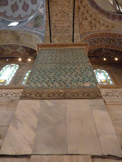
 this one is a riot of colour and pattern. The blue Izmir tiled walls and gilding
 do not reflect the quiet elegance we were drawn to in other mosques.
That's not to say it wasn't stunningly beautiful with the richest materials .  .  .
. . . used for imaginative sight lines.
The kibla is the direct geographical line from the mosque to Mecca, so the front wall of a mosque is the kibla wall. The mihrab is the niche in the wall marking the kibla, to indicate the correct direction for prayer. On the right is the mimber, the high pulpit used for Friday service sermons. 
Outside the Blue Mosque is the Roman Hippodrome, now marked by three ancient columns.
The Egyptian obelisk dating from c. 1500 B.C. was erected here by Theodosius in 390. 
Theodosius added a base to the obelisk with depictions of his family enjoying the
pleasures of the Hippodrome entertainments.
Afterwards we wandered over to the huge market area and spent the afternoon in the Book Bazaar
where we admired framed illustration pages from Qur'ans both antique and new,
but were only slightly tempted to buy.
Then we headed into the vast covered market of the Grand Bazaar. And there we were not
at all tempted to buy a carpet or a bath towel, breaking many sellers hearts.
The arcaded aisles create virtual streets that are named and have addresses. The most fun was looking
 for the address of the kebab stand recommended on the Istanbul Eats app.
And we did after many turns, providing us with a fantastic lunch.
 The streets in the market district were the most fun. A shopper's paradise for anything and everything.
I found so many things I could use if I were only home: beautiful polished wooden coat hangers,
a button shop with more buttons than I have ever seen, huge skeins of cording . . . 
At last we reached our destination at the Spice Market where we did not resist buying
some spice blends and teas and honey and nuts from a nice young man who had lived in England
for many years, but returned home last year to help his father in the family shop her in the Spice Market.
 I'm thinking I might have to go back for a bit more of his merchandise before we leave Istanbul. 

Tuesday, April 2, 2013

On the Sixth Day, Asia

A perfect day, blue sky, sun, a cool breeze, so it was the day for a ferry ride to Asia.
Destination Üsküdar on the Asia side of the Bosphorus.
Spring is finally arriving here. 
A grocery shop in an old bathhouse connected to the mosque.
The Maiden's Tower where Leander did not swim the Bosphorus to see Hero,
because he swam the Hellespont, but the tower is sometimes called Leander's Tower.
 In the background is the western side of the Golden Horn . . .

. . . with the minarets and domes of the Blue Mosque and Haghia Sofia,
and Topkapi Palace, from the Asian side of the Bosphorus.

The Asian side of the Bosphorus
The European side of the Bosphorus
The Bosphorus Bridge that connects two continents and the fantastic fish restaurant in
Kuzguncuk where we ate lunch. A glorious day to visit Asia. The first time for me.

A Fifth Day for Pilgrimage

According to our guidebook author, Mr. Freely, Eyüp, a town on the north edge of Istanbul is perhaps the third most sacred pilgrimage site in the Islamic world because of its shrine to Abu Ayyub al-Ansari (Eyüp in Turkish) a close friend of the Prophet Mohammed. He died and was buried here in the 670s while leading the first attempt by Islamic warriors to conquer the city of Constantinople.

Arriving by ferry, the first sight is a grey and green hillside that is an enormous cemetery.
In fact much of the town is a necropolis . . .
. . . with ordinary tomb markers
. . . and with mausoleums (türbes) for those who could afford them.
And with pretty little private graveyards too.
The mosque was built in 1800 after the usual series of earthquakes
 damaged the older buildings on the site.
Unlike the mosques we visited yesterday, this one was bustling with religious activity.
Pilgrims were  evident in the busy courtyard.
We were permitted to enter the mosque and stand in the visitor area,
but because there was a service in progress with a sermon, men kneeling in prayer,
and women gathered in their galleries, photographs were not permitted. 
The Sadirvan for ritual washing in the center of the courtyard.
And additional taps for men to wash around the walls.
Like so many sites, the sacred Türbe of Ayyub was closed for  building works.
The dome is visible  in the center of the picture. We were able to walk through a passage past a window
where many pilgrims were praying. Once again photos did not seem appropriate.
The tomb was built in 1458, shortly after the successful conquest.